Imagery That Shows the Whole Property
Our real estate services combine professional aerial and ground photography and video for homes, commercial properties, land, developments, multifamily properties, and construction projects. The result is a complete set of marketing assets that shows the property, the site, and its surroundings the way buyers and tenants want to see them.
Why Aerial & Ground Media Together
Pairing aerial perspective with ground-level detail gives every listing a complete story:
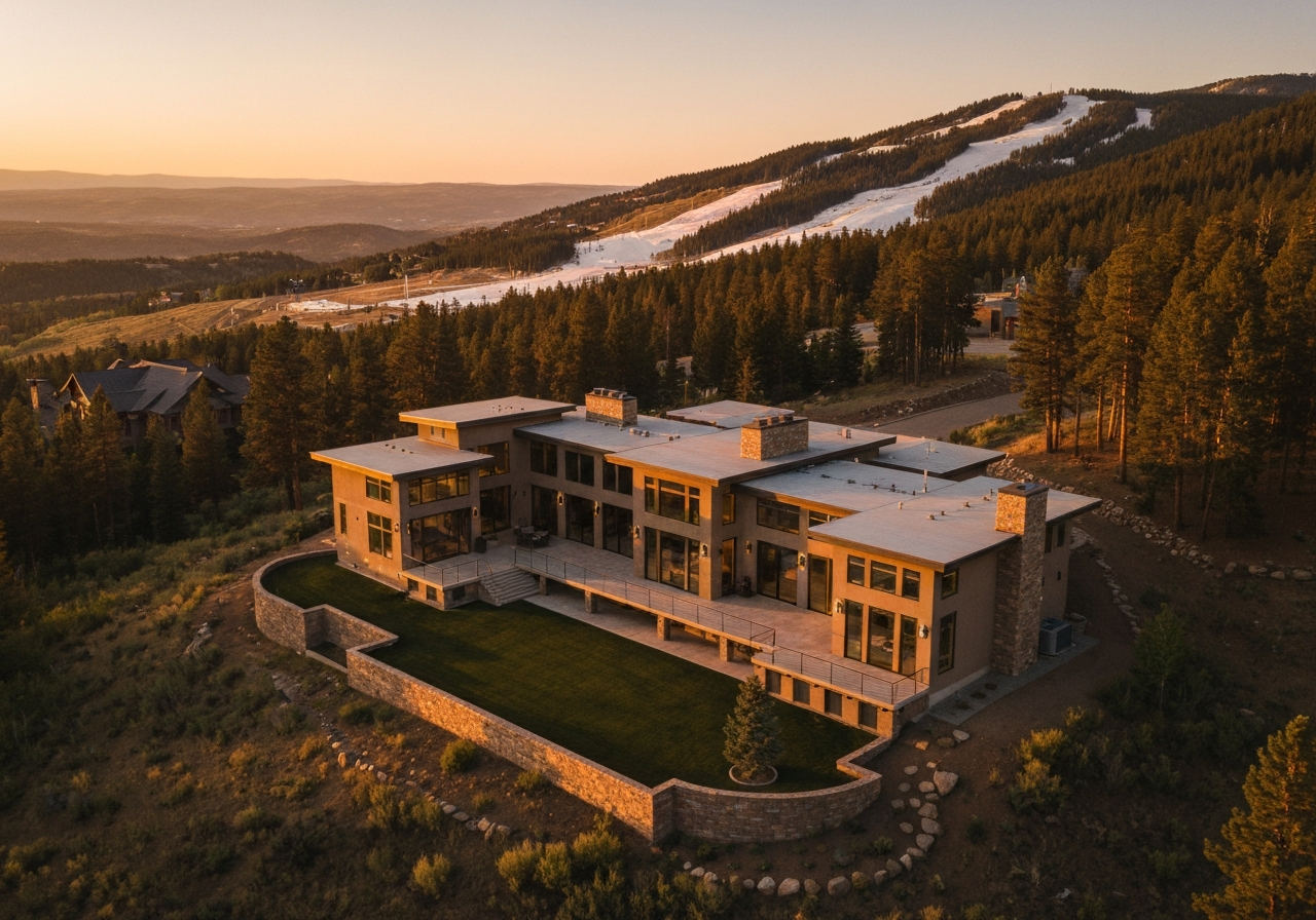
Show the Entire Property Aerial imagery reveals lot size, layout, access, and how structures sit on the land.
Highlight Site Context Capture proximity to roads, parks, open space, mountain views, and nearby development.
Complete Media Package Photography and video delivered together for listings, brochures, and social media.
Property Types We Cover
We photograph and film a wide range of properties across Colorado:
Homes, Land & Multifamily
Single-family homes, acreage and land listings, and multifamily communities.
Commercial & Development
Commercial buildings, developments, and active construction projects.
Commercial & Multi-Unit Residential
Show off a commercial property or multi-unit condo or apartment building with aerial photography and video that gives potential buyers and renters a complete overview of the property and the area around it. Aerial imagery highlights the landscape, the short drive to schools, and the establishments nearby, context that interior photos simply cannot convey.
Homes, Land, and New Development
For residential listings and land, aerial stills and video establish lot lines, acreage, topography, and setting in a way ground photography cannot. On properties still under construction, we can capture views at various elevations for units that have not been completed yet, so marketing can begin well before the building is finished.
FAA Part 107 Certified & Fully Insured
Skywalker Drone Imagery is FAA Part 107 certified and carries $1 million in aviation liability insurance. We serve clients needing anything from straightforward aerial photography to detailed, RTK-corrected mapping and recurring site documentation.