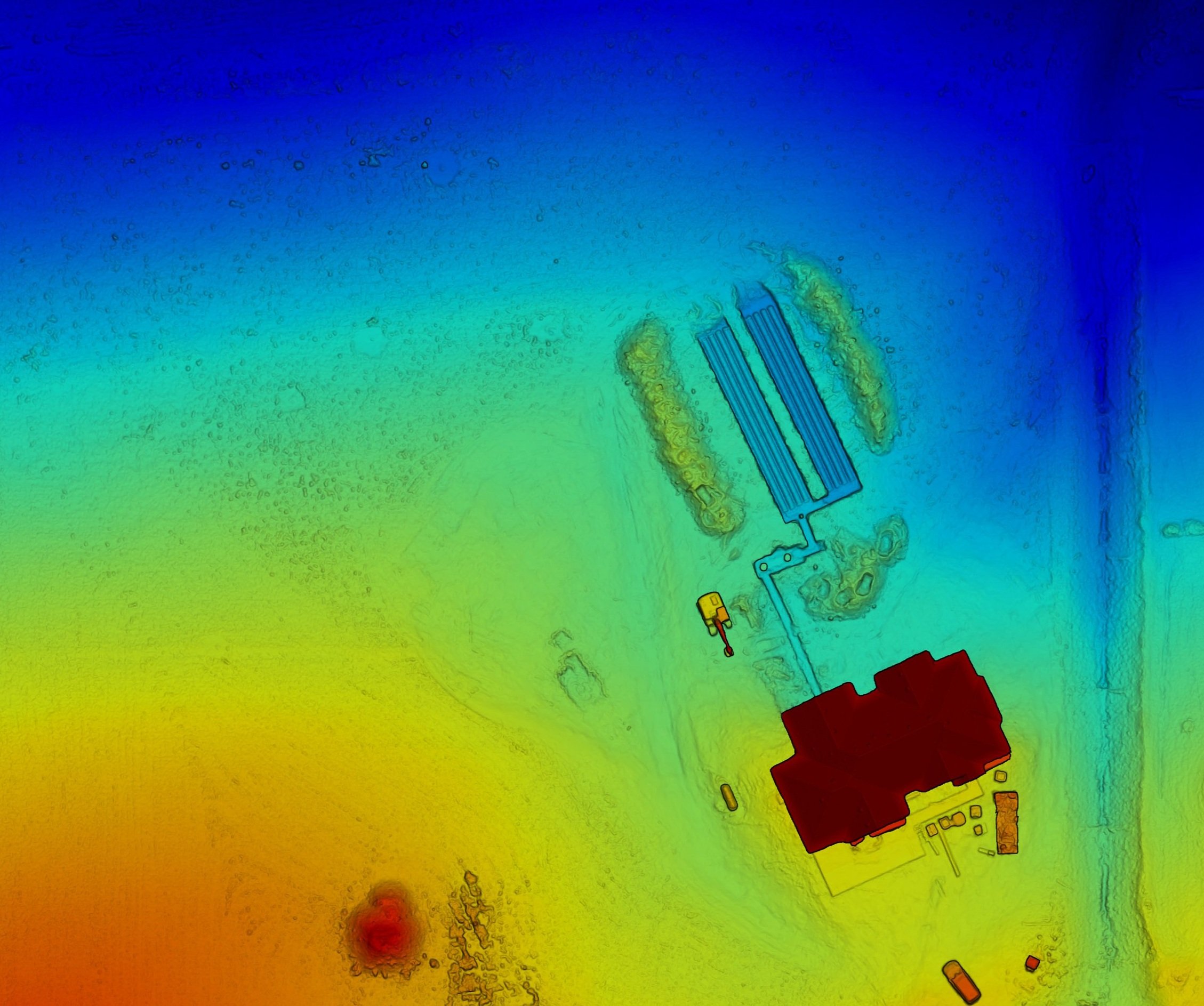
Septic System Record Drawings
Fast, Accurate, Beautiful and Affordable
Fly, Measure and Deliver
Let us take the hassle out of creating county record drawings for your septic installations, STA field repairs, and tank replacements. Using our drones and advanced software, we will survey your entire site, providing precise and efficient measurements for every part of your installation.
How does this work? Can I trust your measurements?
In order to measure your job site remotely, we will use our drones and use a technique called photogrammetry. Here’s how it works:
A drone flies over an area and takes hundreds of overlapping pictures from different angles. These pictures are combined by special software, which creates a 3D model of the ground and everything on it.
With this 3D model, we can accurately measure elevations, distances, areas, and volumes. Since the drone takes so many detailed pictures and the software is super precise, the measurements you get are very trustworthy, repeatable and reliable.
What do we need from you?
-
Property Address: This will help us know if there are any FAA restrictions and all preflight planning.
Coordination. We will need name and number of primary contact so that the flight can be coordinated and scheduled during or after inspection of the install.
-
Submit the following to Skywalker Drone Imagery via email.
1) Permit Number
2) Engineer Company/Name
3) Project Number
4) Components used for the system
5) Engineers Drawing/Plan
-
Considerations:
1) We ask for 3 days notice on scheduling flight
2) FAA authorization for some locations will be necessary
3) Please communicate with homeowners in advance that their install will be surveyed in advance
Restrictions: Cannot fly in the following conditions
1) Rain
2) Snow
3) 20+ MPH winds
Contact Today
Drones are transforming the way record drawings of septic system installations are created, providing faster, more accurate, and more detailed information than traditional methods. Local counties require detailed record drawings for permitting, inspections, and future maintenance, and drones can significantly enhance this process.
Efficient and Accurate Site Surveys
One of the key advantages of using drones for septic system record drawings is the speed and efficiency of site surveys. Traditionally, technicians would have to walk the property, manually measuring distances and elevations with tools like GPS units or laser levels. This process is time-consuming and can be subject to human error. Drones, on the other hand, can cover the entire site in a matter of minutes. Equipped with high-resolution cameras and sensors, drones capture a series of aerial images that provide a complete view of the septic system and the surrounding area.
These images are processed using advanced photogrammetry software to create detailed, accurate maps and 3D models of the site. This allows for precise measurement of distances, slopes, and elevations, ensuring that the record drawings meet county standards. The result is a more reliable and faster way to gather the information required for record drawings.
Elevations, Volumes, and Drainage Considerations
Drones are not only useful for capturing surface details but also for analyzing the terrain. The ability to measure elevations is crucial in septic system design and installation, as drainage patterns and the slope of the land directly impact the system’s functionality. Drones equipped with LiDAR (Light Detection and Ranging) or photogrammetry software can create topographic maps that provide highly accurate elevation data. This information helps in assessing drainage and ensuring that the system is installed on suitable ground. Accurate topographic data also aids in determining the placement of the leach field and other critical components.
Furthermore, drones can be used to calculate volumes, such as the amount of soil moved during excavation or fill. This is especially useful in large or complex septic system installations where earthwork needs to be documented.
High-Resolution Documentation
In addition to speeding up the survey process, drones provide a level of detail that is difficult to achieve through traditional methods. A drone can capture high-resolution images from various angles, documenting the exact layout of the septic system, including the tank, pipes, and drain field. This aerial perspective provides a clearer view of the installation, making it easier to create accurate as-built drawings that reflect the septic system’s layout and relationship to other features on the property.
This high level of detail is especially important when changes to the site, such as STA field repairs or tank replacements, need to be documented. With drone-captured images, counties can trust that the record drawings accurately represent the completed installation, including all modifications.
Compliance with County Regulations
Counties require septic system installers to provide detailed record drawings to ensure that installations meet health and environmental standards. Drones provide a reliable way to gather the data needed for these drawings, reducing the risk of errors or missing information. Drone-captured data can also be integrated with Geographic Information Systems (GIS), which many counties use to track and manage land use. This helps ensure that all necessary details are included in the record drawings and that they meet county requirements.
Drones offer a powerful tool for creating precise, detailed, and efficient record drawings of septic system installations. By improving the accuracy of measurements, reducing survey time, and providing detailed aerial documentation, drones enhance the ability of installers to meet county requirements. For local counties, drones provide a level of trust in the data, ensuring that septic systems are properly documented for future maintenance and compliance.


