
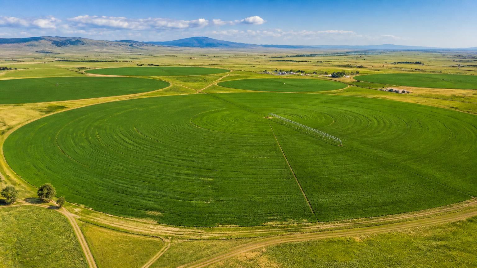
Crop Insights from Above
Agriculture & Environmental services provide plant health analysis, crop stand counts, irrigation and topography mapping, and documentation of crop damage caused by hail, flooding, wind, or other events. These services can provide supporting documentation for crop-loss and insurance claims, helping growers protect their operations.
Benefits for Growers & Land Managers
Aerial data turns field observations into actionable insights:
Plant Health Analysis High-resolution aerial imagery processed with VARI reveals plant health, stress, and vigor across your fields.
Crop Stand Counts Get accurate plant population estimates for planning, replanting, and insurance reporting.
Damage Documentation Document hail, flood, or wind damage to support crop-loss and insurance claims.
Agriculture & Environmental Applications
We support Colorado growers with a range of aerial services:
Irrigation & Drainage Mapping
Map field drainage patterns, irrigation systems, and water flow to improve land management.
Topography & Elevation Data
Contour and elevation surveys that support irrigation design, water management, and land planning decisions.
Insurance Claim Documentation
Time-stamped aerial evidence of crop damage to support claims and recovery decisions.
Plant Health Analysis with VARI
Monitoring large fields accurately and efficiently is a persistent obstacle in farming. High-resolution aerial imagery processed with VARI (Visible Atmospherically Resistant Index) addresses this: plant health problems can be identified and resolved early, limiting damage and protecting yield.
- Early identification of plant health stress and vigor differences across the field
- Topographic contour surveys that provide data for irrigation design
- Detection of irrigation coverage gaps and leak locations
- Better crop load estimates for thinning and management decisions
- Damage mapping after hail, wind, or flooding to support insurance claims
Crop Stand Count Analysis
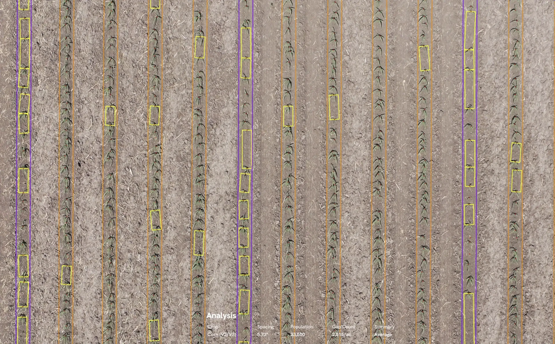
Early-season stand counts are critical for replant and management decisions. Instead of walking sample rows by hand, drone imagery captures the entire field and analysis identifies each plant along every row — reporting spacing, population, and gap counts with a per-field summary.
Field-Level Plant Population Maps
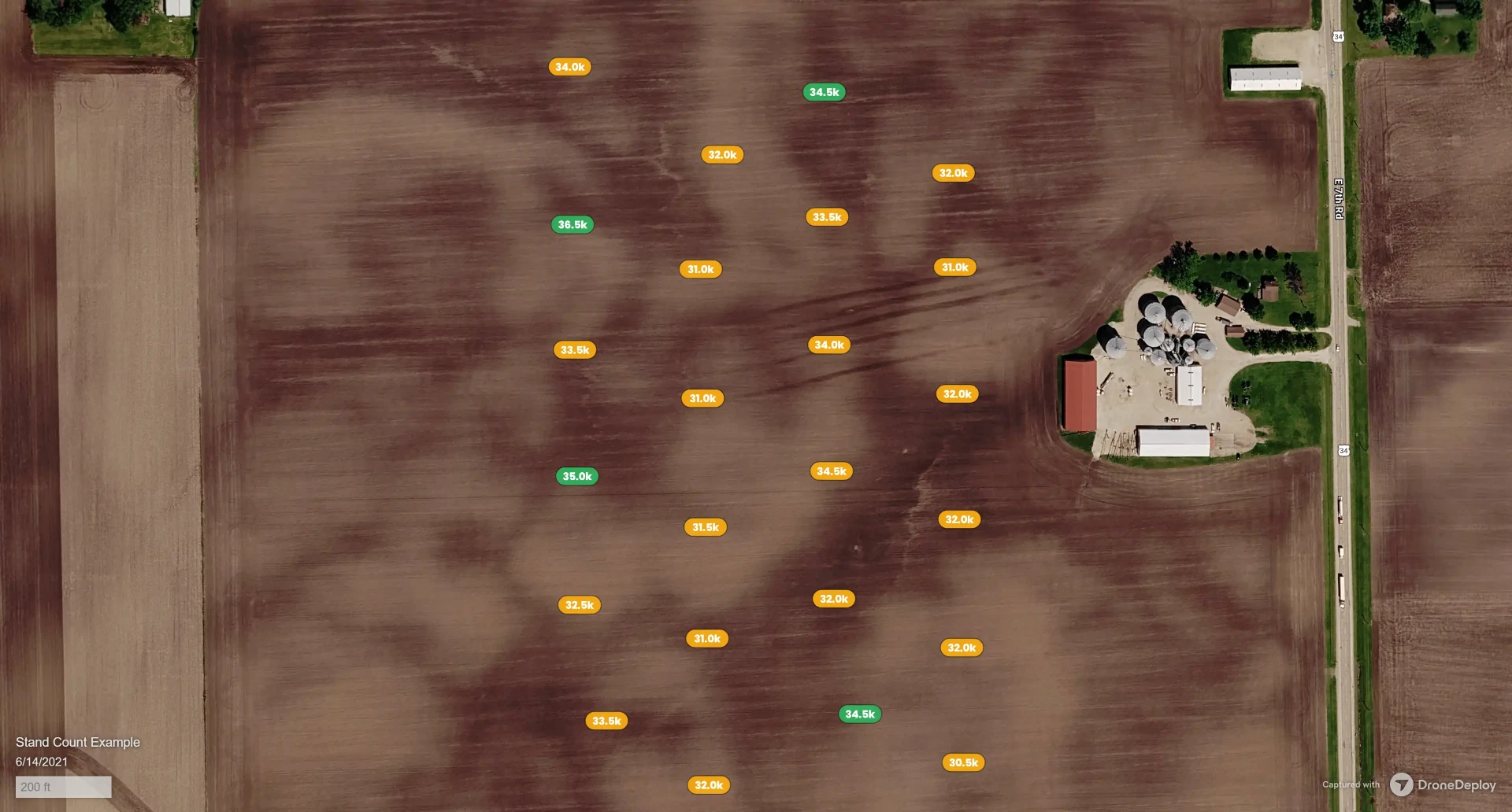
Stand count data is rolled up into a field-level population map, with counts reported zone by zone across the entire field. Low-population areas stand out immediately, so replanting and spot-treatment decisions can be made from real numbers rather than estimates.
Irrigation & Topography Data
Aerial mapping gives growers a clear picture of how water moves across their ground. Topographic contour surveys and elevation data support irrigation design and pivot placement, while drainage mapping reveals where water pools, flows, or escapes — information that is difficult and slow to gather on foot.
- Topographic contour surveys for irrigation design and pivot placement
- Drainage pattern and water flow mapping across the field
- Detection of irrigation coverage gaps and leak locations
- Elevation data that supports land leveling and water management decisions
Turf & Golf Course Management
Aerial imaging is an efficient tool for grounds managers maintaining large turf areas. A drone captures high-resolution imagery of an entire course in a fraction of the time it takes to evaluate conditions on foot, making it far easier to spot stress, drainage problems, and irrigation issues while they are still small.
Supporting Colorado Growers
Skywalker Drone Imagery works with farmers, ranchers, and agricultural professionals across Colorado to deliver timely, accurate aerial data that supports smarter decisions and stronger insurance claims.