Municipal Reality Capture at 0.5 Inches Per Pixel
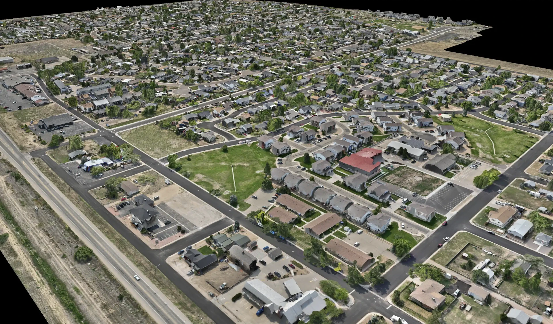
Municipal infrastructure is aging, budgets are tight, and expectations are rising. Getting the information you need to make good decisions is harder than it should be. A single high-resolution capture gives your team a current, accurate, and measurable visual record of your entire community — available the moment a decision needs to be made, without another trip into the field.
One Capture. Many Benefits.
Every department works from the same picture, in the browser, with no software to install:
See Cracks, Patches & Wear. At 0.5" resolution you can proactively identify problems on roads and sidewalks before they become costly repairs.
Inspect Remotely. Answer everyday questions from the office — saving time, reducing site visits, and improving staff safety.
Measure Accurately. Get precise distances, areas, and counts anywhere in your community, then annotate and track issues over time.
Share Across Departments. Break down silos. Public Works, Planning, Parks & Recreation, Engineering, Administration, and Finance all work from one shared resource.
What You Receive
High-resolution aerial captures and easy-to-use deliverables — ready for your team from day one.
High-Resolution Orthomosaic — 0.5" / Pixel
Ultra-detailed, RTK-corrected imagery you can trust for measurement, analysis, and decision-making.
Interactive Online Map
Zoom, measure, annotate, and share. Access your up-to-date imagery anytime, anywhere, and collaborate with your team by sending a link.
GIS-Ready GeoTIFF
Georeferenced, RTK-corrected and Esri compatible — integrates seamlessly with the GIS and CAD workflows you already use.
A Lasting Visual Record
Capture, measure, document. An objective record that preserves institutional knowledge even as staff changes.
One Map. Across Your Municipality.
A complete, high-resolution view of your community helps your team inspect, measure, analyze, and act — all from the office.
- Roads & Sidewalks: pavement conditions, cracks, markings, intersections, curb & gutter, and right-of-way issues
- Stormwater Systems: drainage patterns, culverts, ditches, ponds, detention areas, and potential problem spots
- Parks & Recreation: fields, trails, playgrounds, parking lots, landscaping, and overall park conditions
- Buildings & Facilities: roofs, structures, parking areas, access roads, and surrounding property
- Utilities & Infrastructure: visible assets and the infrastructure that supports your community
Elevation & Terrain Data
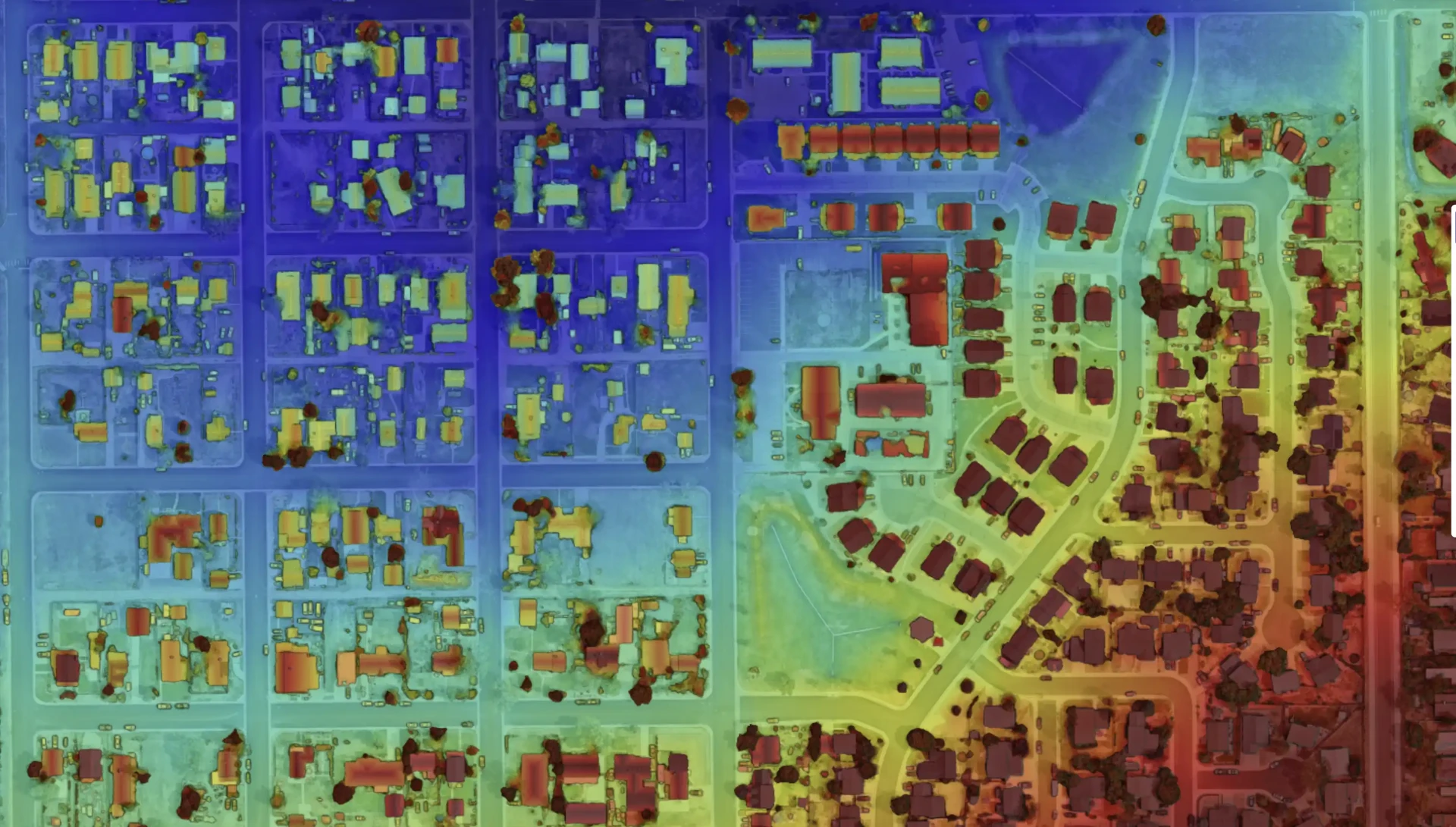
Every capture also produces an elevation model of your community. Color-coded elevation maps make terrain easy to read at a glance — revealing drainage patterns, low points, and grading issues that are hard to spot in standard imagery. It's a powerful tool for stormwater planning, flood-prone area reviews, and infrastructure projects that depend on understanding how water moves across your municipality.
Parks & Vegetation Health
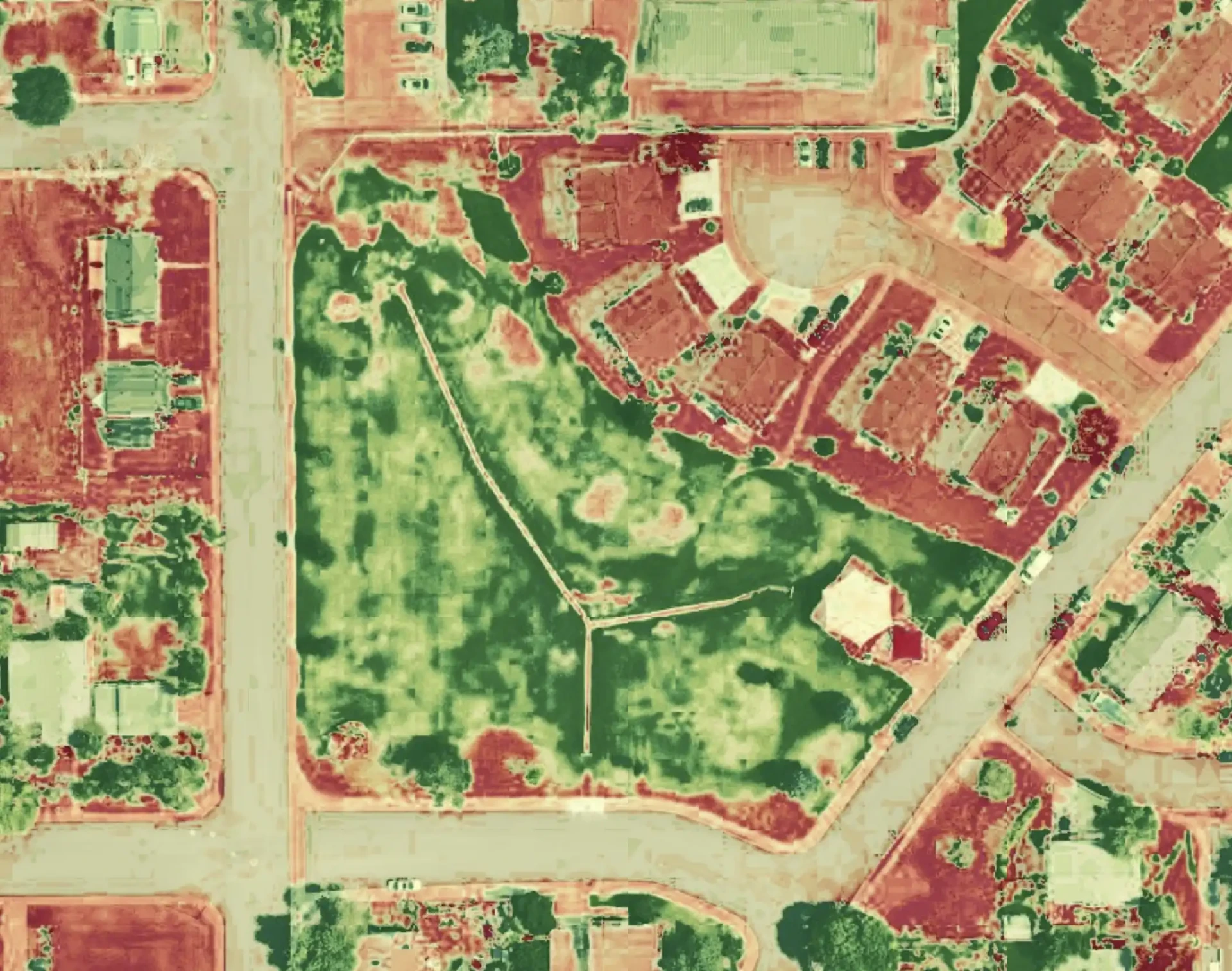
Plant health analysis brings the same clarity to your parks and green spaces. Color-coded vegetation maps show turf and landscape health across every field, park, and right-of-way — highlighting stressed or declining areas long before they're visible from the ground. Parks crews can target irrigation, fertilization, and maintenance where it's actually needed instead of treating every field the same.
The Challenges You Face Every Day
Municipal teams tell us the same things again and again — and one current map answers all of them.
- Where should we spend limited infrastructure dollars first?
- How do we know what's getting worse without a consistent visual record?
- How much of our city are we managing from memory as staff retire?
- Are our departments working from the same picture?
- Can we answer this without another trip into the field?
Accurate Data. Stronger Communities.
The first capture shows you your municipality. The next capture begins to show you its story. Skywalker Drone Imagery is FAA Part 107 certified and carries $1 million in aviation liability insurance, delivering consistent, secure, high-resolution imagery that stays under your control. Let's build a clearer, smarter future together — call +1 720-730-7686 or email luke@skywalkerdroneimagery.com.