Inspect Critical Structures Without Closing Them
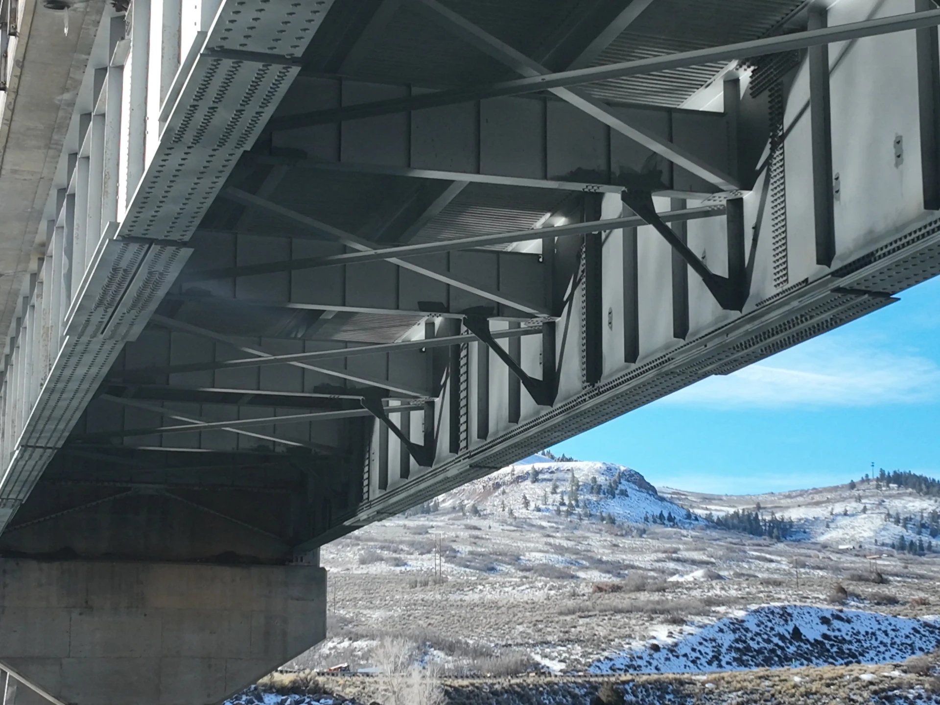
Drones capture detailed imagery of bridges, overpasses, dams, and other infrastructure — including decks, girders, piers, joints, and drainage — without scaffolding, snooper trucks, or traffic closures. Engineers and asset owners get the documentation they need for condition assessments, maintenance planning, and capital budgeting.
Why Use Drones for Infrastructure Inspections?
Aerial inspections deliver clearer data with far less disruption:
Access Hard-to-Reach Structures Inspect undersides, tall piers, and areas over water or traffic that are difficult or dangerous to reach otherwise.
Detailed Visual & Thermal Imaging Identify cracking, spalling, corrosion, and moisture intrusion with exceptional clarity.
Minimize Traffic & Closures Collect comprehensive inspection data without lane closures, detours, or elevated work platforms.
Infrastructure Inspection Applications
We support a wide range of infrastructure assets across Colorado:
Bridges & Overpasses
Decks, girders, bearings, and substructures documented for engineering evaluation and maintenance planning.
Dams, Towers & Utilities
Condition documentation for dams, water towers, tanks, and utility structures that are difficult to access.
A Better Method for Bridge Inspection
Drone imaging has become a genuine shift in how bridges and other infrastructure are inspected. It saves time, improves efficiency, and cuts cost compared with traditional access methods. Crews no longer need to climb into high, risky, hard-to-reach positions, and under-deck, pier, and cable sections can be viewed in detail at short notice without snooper trucks, lane closures, or lengthy preparation.
- Bridge decks, girders, bearings, piers, and abutments
- Pipelines, culverts, and stormwater structures
- Dams, retaining walls, and shoreline structures
- Post-event damage assessment after flooding, impact, or fire
Repeatable Records Over Time
Flights can be repeated along the same path so images align from one inspection cycle to the next. That makes crack growth, spalling, corrosion, and scour easy to compare across years and gives engineers documentation they can attach directly to condition reports and funding requests.
FAA Part 107 Certified & Fully Insured
Skywalker Drone Imagery is FAA Part 107 certified and carries $1 million in aviation liability insurance, giving you confidence that every inspection is conducted professionally, safely, and in full compliance with federal and local regulations.